Course Code: CGSRS
Level: Certificate
Duration: 2 Years
OVERVIEW
About the Programme
New emerging technologies like Geographical Information Systems (GIS) and Remote Sensing (RS) helps in solving complex man made world issues and touching all aspect of life. The role of a Geospatial specialist is becoming more and more important in the decision making process. Practical knowledge is very crucial in order to understand the concept deeply to explore the innovative use of the technology and its application areas. The courses in GIS & Remote Sensing is of interest to people in many fields; it is a valuable complement to studies in social and natural sciences programs such as anthropology, biology, computer sciences, earth sciences, economics, engineering, environmental sciences, geography, health and medicine, history, physical oceanography, political sciences, resource management, and the study of languages. Cartography, geographic information systems, and remote sensing provide effective methods of gathering, managing, analysing and representing geographic information.
- Cartography involves the compilation, organization, and visual representation of spatial information in a presentational form (i.e. map) that efficiently communicates geographic relationships.
- Geographic information systems enable the compilation, organization, and processing of spatial (i.e., maps) as well as non-spatial (i.e., text, statistics, and graphs) data. Socio-economic, political and environmental management decision-making is supported by the results of geographic information system analyses and modeling.
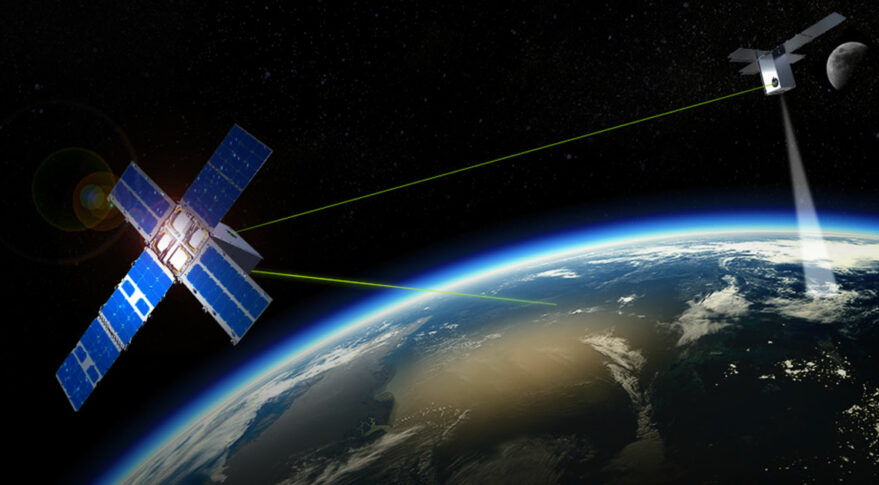
- Remote sensing images, recorded from aircrafts and satellites, provide resourceful information to observe and study the cultural and physical landscapes. Examples of remote sensing applications include land cover mapping, environmental quality evaluation, and natural resources exploration, assessment and monitoring.
OBJECTIVES OF THE COURSE:
- Students should become familiar with advanced GIS concepts and geographical analysis tools;
- Students should be able to apply a variety of geographical analysis tools to spatial problems;
- Students should know how to analyze the spatial aspects of both quantitative and qualitative data;
- Students have the skills to implement a particular geographical analysis for a spatial social science research problem;
- Students should be able to critically reflect on the GIS concepts and the choice of geographical analysis (tool) and given data;
- Students should able to present and report the outcome of a geographical analysis.
COURSE CONTENT:
Geographical Information Systems (GIS) and other geographical analysis tools such as Google Earth or Geo Data are systems to create, analyze and present spatial data. These tools can be used for a variety of purposes where the geographical location and spatial context is relevant. Examples are physical planning, vulnerability and risk analysis, suitability analysis, accessibility studies and spatial inequalities studies. The last decade can be characterized by an increase in GIS data and (open source) tools to analyse these data, easier access to GIS data, and also the creation of spatial data by non-GIS experts, facilitated by location-based devices like cameras and mobile phones with GPS functionality. Accordingly, in the recent years various GIS approaches and techniques have also emerged in the field of the social sciences allowing us to incorporate the spatial dimension of certain phenomena. Moreover, thanks to many low-key initiatives there is a wide variety of data sources and tools which help us to solve spatial research problems.
In this course students will become familiar with different types of data and GIS tools which could be very useful for solving spatial social science research questions, and more importantly, how these techniques can be applied to the students? Research interest and enrich them as social scientists.
WHO SHOULD ATTEND THIS COURSE?
This course is relevant for the students who seek to develop a career or professional graduates in Earth Sciences (Geography, Geology, Environment, Disaster management) and for the students from other field like B.sc, computer science, engineering, architecture, agriculture, and mining who wish to build their career in geospatial industry and want to be proficient in applying geo-information science in their respective field.
WHAT WILL BE ACHIEVED?
The objective of the course is to develop an understanding and competence in, Geo spatial technology.
- Analyze geo-information problems encountered in professional domain and develop, apply the appropriate methods for studying and/or solving the problems
- Learn different technologies for collecting, acquiring and verifying spatial data
- Different Technology to generate, integrates, analyze and visualize spatial data
- Apply practical skills by working on international standard projects
- To carry out an independent final project and presentation
PROGRAMME STRUCTURE
Year One Semester One
- CCS111 Introduction to Computing & IT
- CGS-RS111 Principles of Remote Sensing
- CGS-RS112 Principles of Geographic Information Systems (GIS)
- CGS-RS113 Basics of Global Positioning System(GPS)
- CJM115 Communication Skills
Year One Semester Two
- CGS-RS121 Cartography & Digital Mapping
- CGS-RS122 Spatial Data, Analysis and Modeling
- CGS-RS123 Applied GIS
- CGS-RS124 Emerging Trends in GIS & Remote Sensing
- CSAI123 Database Management Systems
Year Two Semester One
- CGS-RS211 Digital Image Processing
- CGS-RS212 Geoinformatics for Natural Disaster Management
- CGS-RS213 Geoinformatics for Health & Epidemiology
- CGS-RS214 Research Methodology
Year Two Semester Two
- CGS-RS221 Geo-spatial Programming
- CGS-RS222 Geo-Database Management
- CCS221 Ethical, Legal, and Social Issues in Technology
- CGS-RS225 Final Year Project/Thesis
Industrial training
- CGS-RS226 Industrial Attachment (8 weeks)
CAREER PROSPECTS
The career opportunities available to students with a Certificate in GIS & Remote Sensing vary greatly. Some of the more popular options include: Earth Science Specialists, Geography Specialists, Geologists, Environmentalists, Disaster management Specialists, Urban Planners and Architect, Mining, among others.
ENTRY REQUIREMENTS
Option A
The Uganda Certificate of Education (UCE) with at least 5 credits obtained at the same sitting, or it’s equivalent..
Option B
A Certificate from a recognized institution of learning within the same, or in a related field.
COURSE FEES (PER ACADEMIC YEAR)
Semester I
| Fees | For Nationals | For International Students |
| Tuition (Per Semester) | 475,000/= | $275 |
| Functional Fees (Payable once a year) | 280,000/= | $125 |
| Total | 705,000/= | $400 |
Semester II
| Fees | For Nationals | For International Students |
| Tuition (Per Semester) | 475,000/= | $275 |
| Functional Fees | N/A | N/A |
| Total | 475,000/= | $275 |
